See it before you install it
The forecaster's own discussion
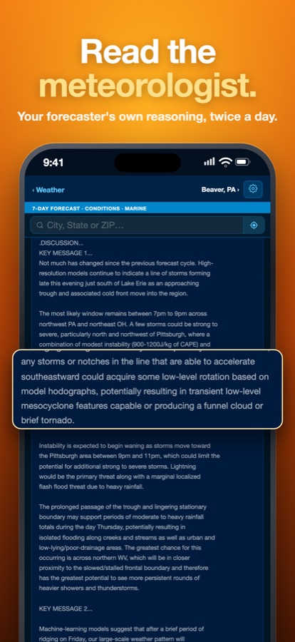
Twice a day, every National Weather Service office publishes an Area Forecast Discussion: the forecaster's reasoning: where the models disagree, what they're watching, and how confident they are. Most weather apps don't show it. This app puts it on the main screen, in full.
"…could acquire some low-level rotation…potentially resulting in transient low-level mesocyclone features capable of producing a funnel cloud or brief tornado."
That's a real line from a discussion, written hours before the storms. It says what the storms might do, which a "40% chance of storms" doesn't.
Everything the NWS issues, in one place
From NOAA and National Weather Service data, credited to the office or station that issued it.
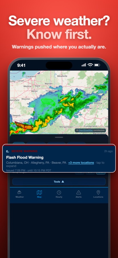
Tornado, storm & severe weather alerts
- Push alerts for NWS warnings, watches and advisories where you are: tornado, severe thunderstorm, flash flood, winter storm, hurricane, heat and more
- One notification per event. You're notified again only if it becomes more dangerous or a warning or watch is extended.
- Your own severity threshold and quiet hours
- Alert map filterable by warning, watch and advisory
Live Doppler radar
- NOAA RIDGE2 NEXRAD radar
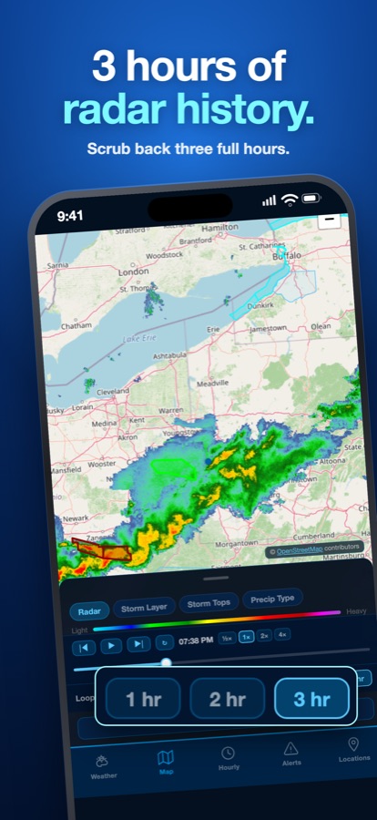
- 1, 2 or 3-hour loops with a drag-to-scrub timeline
- Reflectivity, Storm Layer, Storm Tops and Precipitation Type, which shows rain and snow separately
- Warning polygons drawn over the storms
Lightning
- NOAA lightning strike density from U.S. and global detection networks
- A separate loop in 15-minute frames, next to Radar and Satellite
Hurricanes & tropical storms
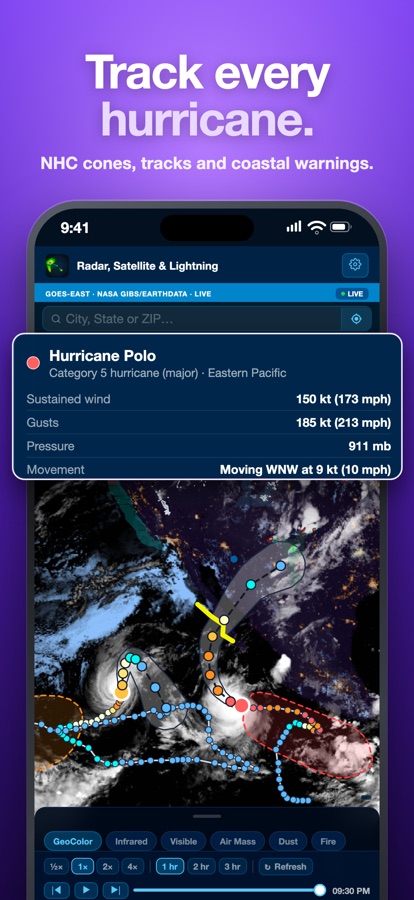
- National Hurricane Center forecast cones, tracks and past tracks
- Coastal hurricane and tropical storm watches and warnings
- Category, winds, pressure and movement for every active storm, plus NHC's 7-day outlook for where new storms may form
Winter storms
- Snow and ice expected for each of the next 7 days
- WPC's Winter Storm Severity Index: how disruptive a storm will be, and whether snow, ice or wind is the main threat
- The odds of 4, 8 or 12 inches of snow, or a quarter inch of ice
Storm Center
- SPC convective outlooks, Marginal through High risk
- SPC mesoscale discussions as they're issued
- 12 raw NWS text products: Hazardous Weather Outlook, Local Storm Reports, winter and fire weather, flood outlooks and more
Satellite
- Animated GOES-East imagery
- GeoColor, Infrared, Visible, Air Mass, Dust and Fire Temperature
- Shows smoke, dust and wildfire hot spots
Climate & records
- Today against the 1991–2020 normal and the all-time record
- Rainfall and snowfall to date against normal
- Dry streaks counted from the daily records
Forecast & widgets
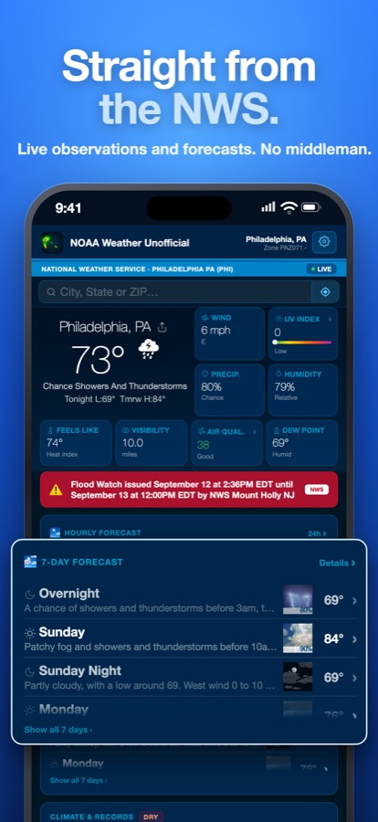
- 7-day NWS forecast plus a 14-day outlook, clearly marked as model guidance
- NOAA's 6–10 and 8–14 day outlooks: the odds of warmer, cooler, wetter or drier than normal
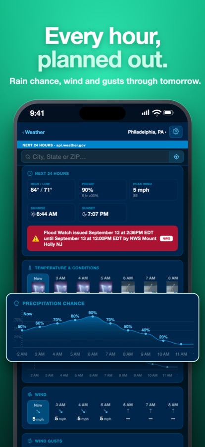
- Hourly timeline, air quality, UV and full conditions
- Six widget sizes, including three Lock Screen widgets
Who it's for
Storm spotters and chasers, weather hobbyists, farmers, boaters, and anyone who wants to know why the forecast changed.
Private by design
No account, no ads, no tracking, no analytics. Your location is used to get your forecast and alerts. It is never sold or shared for advertising. Read the privacy policy.